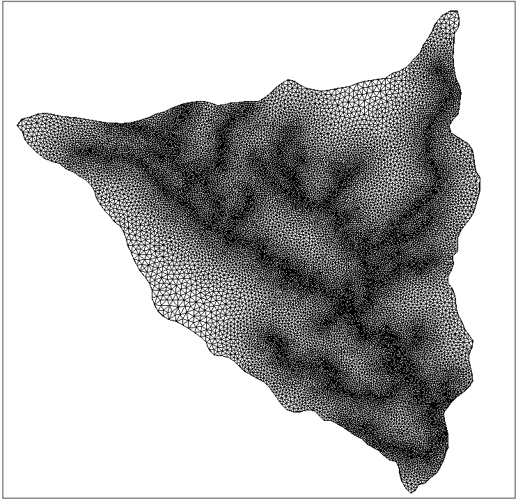
The high computational cost of large-scale, process-based hydrological simulations can be approached using variable resolution meshes, where only the region around significant topographic features is refined. However, generating quality variable resolution meshes from digital elevation data is non-trivial. In literature, usually a slope or curvature-based criterion is defined to detect regions of refinement. These techniques often involve a number of free parameters that control the finest and coarsest resolutions, and the transition between fine resolution to coarse resolution. The influence of these parameters on the resulting mesh is usually not well-understood. In order to overcome the large number of free parameters involved, we propose to carry out the Mallat decomposition of the digital elevation data using the Haar wavelet. This gives a nested multilevel representation of the elevation data, split into average coefficients and detail coefficients. Applying hard-thresholding to these detail coefficients assigns a required level of refinement to each data point. This reduces the number of free parameters to exactly one: the acceptable error threshold. In this presentation, we focus on identifying which geomorphometric parameter(s) should be used to steer mesh refinement. We compare zero-inertia model simulation runs on meshes generated by decomposing elevation and slope. We hypothesize that because of the form of the Haar wavelet, the first mesh refinement essentially is using the gradient information, while the latter is using the curvature as refinement criterion. Our results suggest that in high-elevation catchments the curvature of the topography is a far better indicator for refinement than the slope. Using the Mallat decomposition on the tensor of the first derivative of the bed elevation (i.e., bed slope) for mesh refinement yields better agreement in the hydrograph compared to the decomposition of the bed elevation. We present surface runoff results for the Lower Triangle catchment, CO, USA, to illustrate the performance of the wavelet-based local mesh refinement.