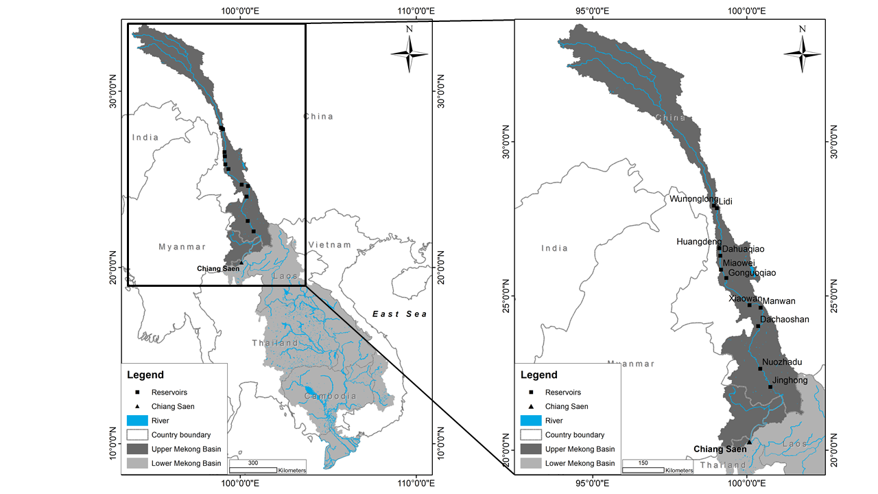
The Langcang-Mekong River Basin is the most important transboundary river basin in Asia. However, over the recent decades, dam construction has been increasingly recognized as having profound effects on hydrological processes, aquatic and riparian ecosystems. Understanding these impacts is critical for the foundation of sustainable runoff surface management. In this study, different methods based on both graphical and numerical techniques were applied to assess the effects of the dams on annual, seasonal, and monthly runoff and to detect hydroclimatic trends in the Upper Mekong Basin during the period 1960–2020. The results reveal two change points with respect to seasonal and annual flow regimes; that is 2003 for the flood season and annual flows, and 2013 for the dry season flow. The duration of the flood season and the volume of annual discharges have both significantly decreased since 2003 and the dry season discharge has significantly increased since 2013 (with both p-values < 0.05). The quantitative assessment suggests that, due to the effect of dams, the monthly discharges increased around 10–450 m3/s during the dry season (December to May), while the flood season’s monthly flows decreased significantly, approximately 1028–2150 m3/s from July to October at Chiang Saen station. The study of hydrological changes in the Mekong watershed is expected to be a significant contribution towards a better understanding of large watersheds in which the hydrological responses are influenced not only by climate change at large spatial and temporal scales but also by changes in the physical environment due to the construction of dams.