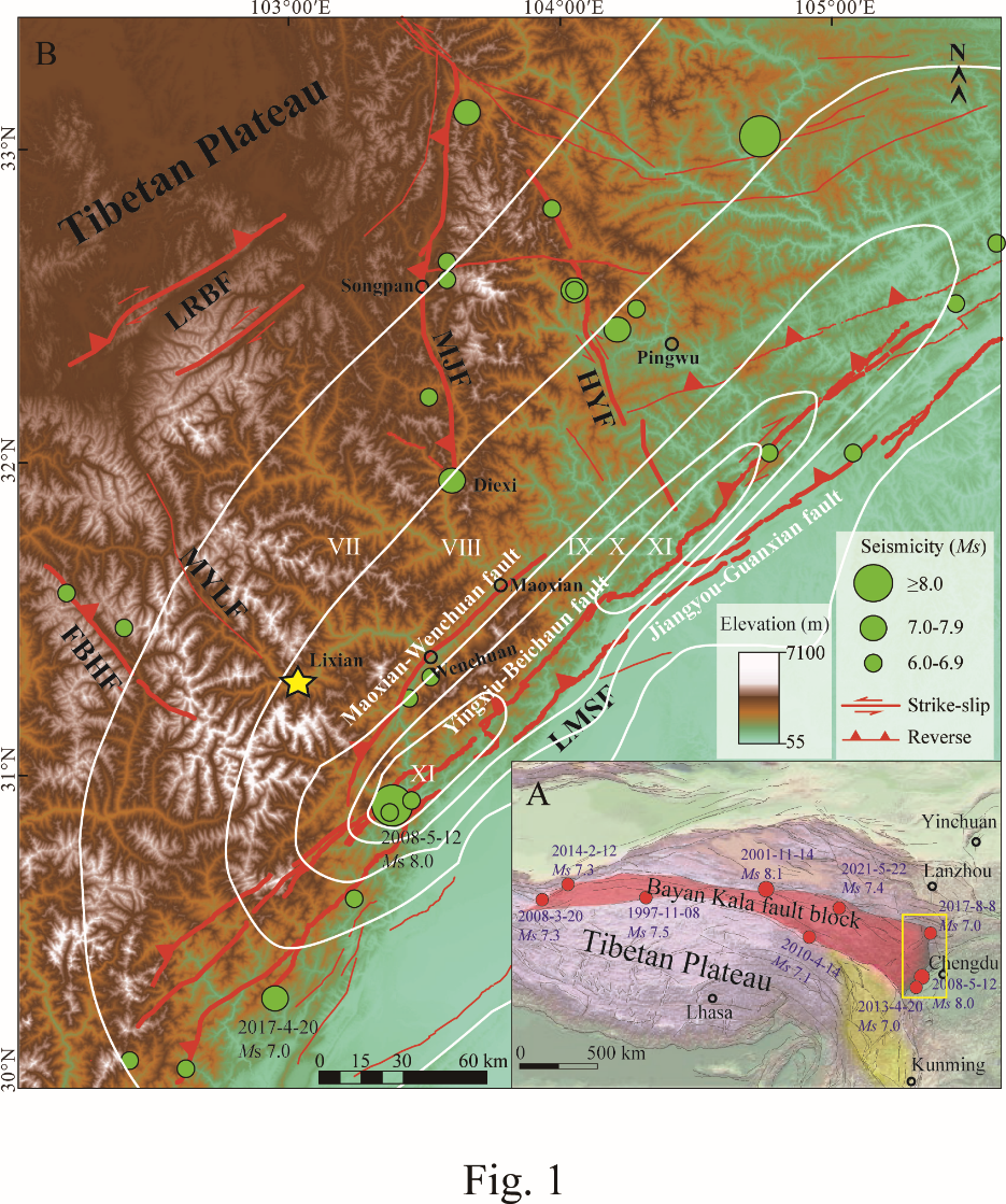
Key Points: • Three areas of tectonic activity are identified by analysis of the fluvial sediments from the Min River in eastern Tibet. • The dominance of fluvial silts, low relief and low slope-angles indicate weak activity of the Minjiang fault. • Stepwise increases in sands, relief, and slope-angle reveal increased tecton-ism in the Diexi-Wenchuan-Dujiangyan segments. Abstract The deposition of fluvial sediments in the tectonically active areas is mainly controlled by climate change and tectonic activity, meaning that fluvial sediments can provide a valuable record of regional climatic and tectonic signals. In this study, a detailed analysis was conducted on the grain-size of modern fluvial sediments from the upper Min River in eastern Tibet, and these data were combined with regional information about the vegetation, hydrology and geomorphology. The results indicate that modern regional tectonic activity in the study area can be divided into three segments. The fluvial sediments in Minjiangyuan-Diexi segment are dominated by fine silts (<63 ï¿¿m: 70.2%), showing low runoff and rainfall conditions and revealing a windblown origin influenced by climate change. This observation is consistent with the small hillslope angle and low relief in this segment, indicating weak activity of Minjiang fault. The coarse-grained fraction (>250 ï¿¿m) of fluvial sediments in Diexi-Wenchuan-Dujiangyan segments increases stepwise (A:6.2%, B:19.4%, C:33.8%) with a stable hydrological conditions, which corresponds well to the increasing trend in the regional relief and the steepness of hillslope angles. These observations indicate the phased enhancement of regional tectonic activity for Maoxian-Wenchuan fault. The fluvial sediments in Dujiangyan-Sichuan basin segment show good sorting and rounding, which is well correlated with significant increases in rainfall and runoff. There is also almost no evidence of tectonic activity in this segment. This study first develops an important research approach for revealing regional tectonic activity through fluvial sediment analysis in tectonically active regions. Plain Language Summary In tectonically active areas, intense tectonic activity tends to create steep ge-omorphology, and deeply affect erosion and sedimentation of river systems. Hence, whether fluvial sediments document changes of regional tectonic activity 1 deserve detailed investigation. In this study, the fluvial sediment of the Min River in the eastern Tibetan Plateau is taken as the research object. Based on grain size analysis of the Min River sediments, we reveal the close correlation between grain size variation and tectonic activity, under the comprehensive comparison of regional topography and geomorphology (slope, height difference) and hydrological conditions. We find that the fine-grained fluvial sediments from the Minjiangyuan to Diexi segment correspond to the weak fault activity of the Minjiang Fault, while the significant increase of coarse-grained composition from Diexi to Dujiangyan segment correspond to the enhancement of fault activity of the Maoxian-Wenchuan fault. This is supported by the greater slope angles and mountain relief from Diexi to Dujiangyan. Novelty of the research methods and reliability of results in this study provide a good reference for revealing regional tectonic activity through fluvial sediments in tectonically active areas.